 A national churchyard mapping project is being launched in our diocese at the end of the month.
Kirkburton, All Hallows and Shelley, Emmanuel, two churches near Huddersfield received a Sharing Heritage grant of £6,100 in March 2018 from The National Lottery Heritage Fund for the pilot project focused on their two churchyards.
This innovative project involved pioneering research to develop the distinctive heritage of the two churchyards, and will add great value for the local and wider communities of all ages.
This is the first project of its kind in the UK to go live and genealogists, historians and interested parties will benefit greatly from easy online-access to search for information.
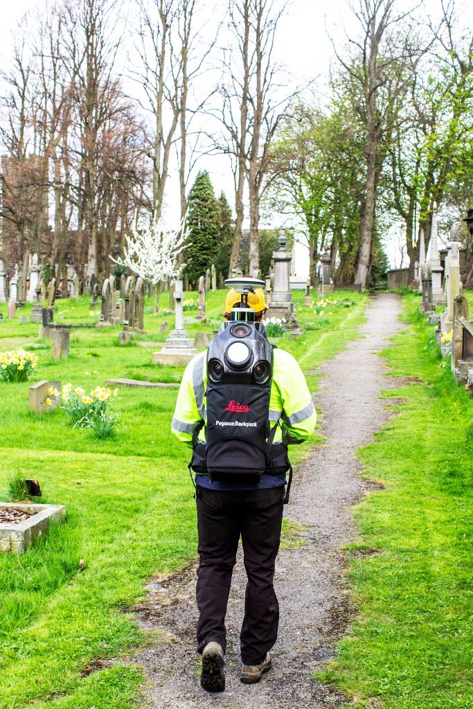
Atlantic Geomatics (UK) Ltd digitally mapped the historic churchyards of Kirkburton and Shelley. Volunteers from the churches and local history group were trained to take high-quality photographs of approximately 6000 memorials, which are now linked directly to the memorial location on the map.
The burial registers were scanned and the volunteers transcribed the text in the registers onto the portal, linking them to the images and map.
This project in conjunction with existing information, benefits the conservation areas of both churchyards, in particular in All Hallows’ Churchyard which for many years has won the Green Flag Community Award.
The churches are committed to upholding their conservation responsibilities and this project helps do this in a systematic way.
The project can now be shared with and benefit:
- The growing community of local, national and international genealogists who have an interest in this area.
- All who live/work in the two villages (now and ongoing) as they can learn about the people who are buried in the churchyards.
- Schoolchildren and their families, as the heritage project incorporates part of the whole school curriculum plans specifically on subjects including Maths, Geography, Science and History.
- Visitors to both churches can examine the results of the project in a variety of ways – by attending talks, guided trails, exhibitions, using the mapping system, educational resources and other events.
Dr Joseph Elders, Head of Strategy for Church Buildings of the Cathedral and Church Buildings Division of the Church of England said “I congratulate the congregations, volunteers and Sylvia Johnson in particular (as Chair of the Group), for all their hard work in bringing this exciting project to fruition. Many more churches could benefit from this kind of project across the country, protecting and enjoying the wonderful historic and natural environment of our churches for the benefit of all”.
Commenting on the launch of the portal, Tim Viney, Atlantic Geomatics Ltd, said: “The team of volunteers at the United Benefice has been a pleasure to work with. They have dedicated much of their time to complement the mapping of the churchyards and added the value that has made it all worthwhile. We are excited at the prospect of the first public Burial Ground Management System to be launched today, the result of several years of hard work.”
The public launches of the pilot project, by Ven Dr Anne Dawtry, Archdeacon of Halifax will be on Wednesday, February 26 at All Hallows and Thursday, February 27 at Emmanuel - both at 10.30 and all are welcome.